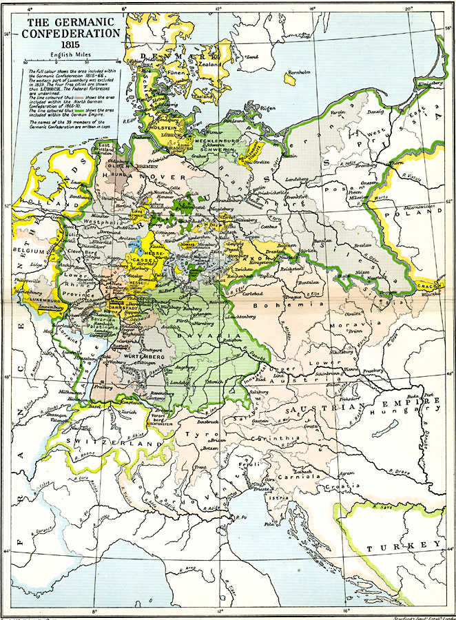
Description: A map of Central Europe showing The Germanic Confederation in 1815. "The full colour shows the area included within the Germanic Confederation 1815–1866. The western part of Luxemburg was excluded in 1839. The four free cities are shown thus LÜBECK. The Federal fortresses are underlined. The line coloured thus [gray] shows the area included within the North German Confederation of 1866–1870. The line coloured thus [green] shows the area included within the German Empire. The names of the 39 members of the Germanic Confederation are written in caps."
Place Names: Central Europe, Bavaria, �Brandenburg, �Hanover, �Hesse-Cassel, �Mecklenburg, �Prussia, �Saxony, �Silesia, �Wurtemburg,
ISO Topic Categories: oceans,
location,
inlandWaters,
boundaries
Keywords: The Germanic Confederation, political, �historical, kGermanConfederacy, country borders,
local jurisdictions,
major political subdivisions, historical event, oceans,
location,
inlandWaters,
boundaries, Unknown, 1815–1870
Source: Ward, Prothero, and Leathes, The Cambridge Modern History Atlas (New York, NY: The Macmillan Company, 1912)
Map Credit: Courtesy the private collection of Roy Winkelman |
|
