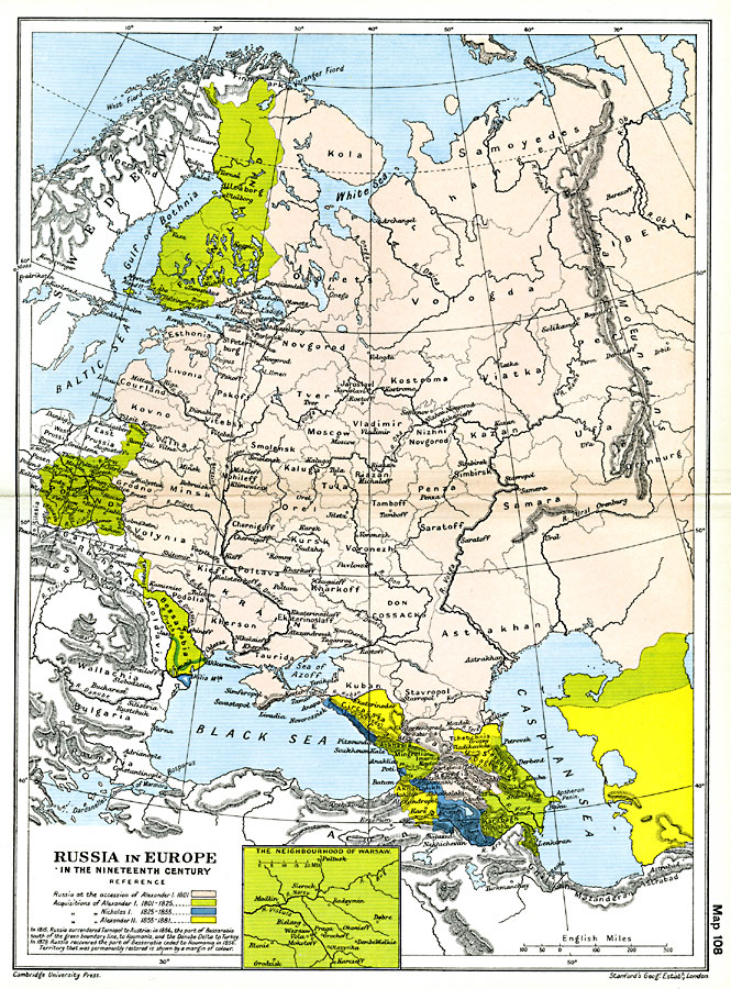
Description: A map showing Russia in Europe between 1801 and 1881. The map is color–coded to show Russia at the accession of Alexander I in 1801 and his territorial acquisitions between 1801–1825, the territorial acquisitions of Nicholas I in 1825–1855, and the acquisitions of Alexander II in 1855–1881. The map shows the provinces, major cities, rivers, large bodies of water, and mountain systems of the region, and an inset map of the environs of Warsaw. Map note: "In 1815, Russia surrendered Tarnopol to Austria: in 1856, the part of Bessarabia south of the green boundary line, to Roumania, and the Danube Delta to Turkey. In 1878 Russia recovered the part of Bessarabia ceded to Roumania in 1856. Territory that was permanently restored is shown by a margin of colour."
Place Names: Eastern Europe, Bessarabia, �Caucasia, �Circassia, �Finland, �Greece, �Poland, �Russia, �Siberia, �Ukrain
ISO Topic Categories: oceans,
location,
inlandWaters,
boundaries
Keywords: Russia in Europe in the Nineteenth Century, political, �historical, country borders,
local jurisdictions,
major political subdivisions, other military, oceans,
location,
inlandWaters,
boundaries, Unknown, 1815–1870
Source: Ward, Prothero, and Leathes, The Cambridge Modern History Atlas (New York, NY: The Macmillan Company, 1912)
Map Credit: Courtesy the private collection of Roy Winkelman |
|