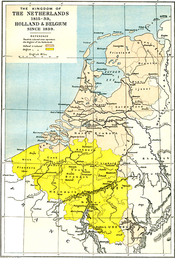
Description: A map showing The Kingdom of the Netherlands, established by the Conference of Vienna in 1815, and the countries of Holland and Belgium since the treaty of London established an independent Belgium in1839 current to 1912. "The whole coloured area represents the Kingdom of the Netherlands. Holland is coloured [pink], Belgium is coloured [yellow]." This map shows major cities, Zuyder Zee, canals and rivers, and the divisions of Groningen, Friesland, Drenthe, Holland, Utrecht, Overijssel, Gelderland, Zeeland, North Brabant, Limburg, and eastern Luxemburg in Holland, and Antwerp, East and West Flanders, South Brabant, Limburg, Hainault, Liege, Namur, and western Luxemburg in Belgium.
Place Names: Low Countries, Belgium, �Holland, �Netherland
ISO Topic Categories: oceans,
location,
inlandWaters,
boundaries
Keywords: The Kingdom of the Netherlands, Holland and Belgium, political, country borders,
local jurisdictions,
major political subdivisions, oceans,
location,
inlandWaters,
boundaries, Unknown, 1815–1912
Source: Ward, Prothero, and Leathes, The Cambridge Modern History Atlas (New York, NY: The Macmillan Company, 1912)
Map Credit: Courtesy the private collection of Roy Winkelman |
|