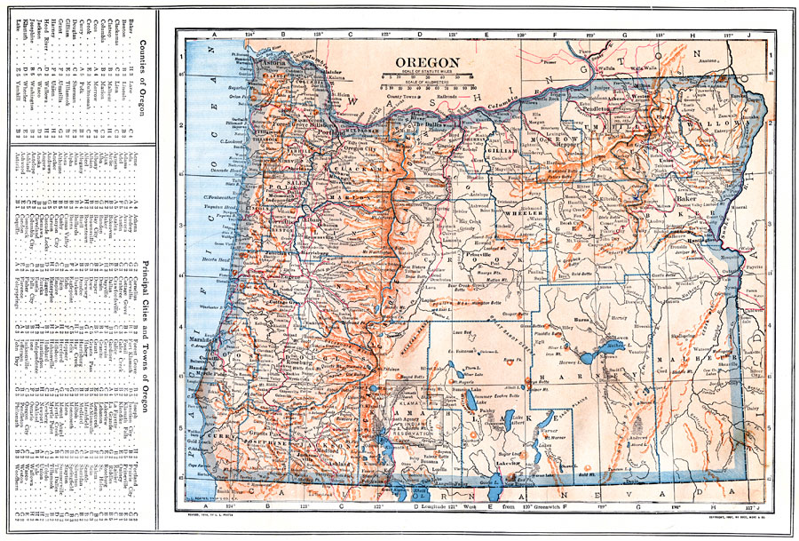
Description: A map from 1914 of Oregon showing the capital of Salem, counties and county seats, principal cities and towns, Indian reservations, railroads, mountain systems, lakes, rivers, and coastal features. A grid reference in the margin of the map lists counties, principal cities, and towns of Oregon.
Place Names: Oregon, Astoria, �Portland, �Oregon City, �Salem, �Dalles, �Albany, �Eugene City, �Rosebur
ISO Topic Categories: boundaries,
inlandWaters,
location,
oceans,
transportation
Keywords: Oregon, physical, �political, �transportation, kNativeAmerican, physical features, county borders, railroads, boundaries,
inlandWaters,
location,
oceans,
transportation, Unknown, 1914
Source: , The New Encyclopedic Atlas and Gazetteer of the World (New York, NY: P. F. Collier and Son, 1914) 44
Map Credit: Courtesy the private collection of Roy Winkelman |
|