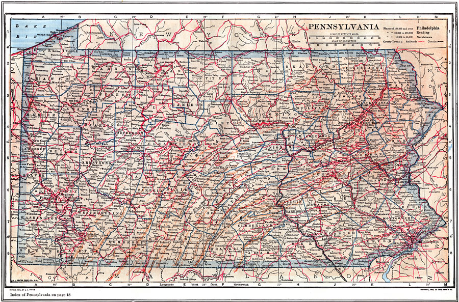
Description: A map from 1914 of Pennsylvania showing the capital at Harrisburg, counties and county seats, principal cities and towns, railroads, canals, mountain systems, shoreline on Lake Erie, and rivers. A grid reference in the margin of the map lists counties, principal cities, and towns of Pennsylvania.
Place Names: Pennsylvania, Harrisburg, �Philadelphia, �Pittsburg, �Allegheny, �Scranton, �Reading, �Erie, �Lancaste
ISO Topic Categories: boundaries,
inlandWaters,
location,
transportation
Keywords: Pennsylvania, physical, �political, �transportation, physical features, county borders, railroads,
water routes, boundaries,
inlandWaters,
location,
transportation, Unknown, 1914
Source: , The New Encyclopedic Atlas and Gazetteer of the World (New York, NY: P. F. Collier and Son, 1914) 45
Map Credit: Courtesy the private collection of Roy Winkelman |
|