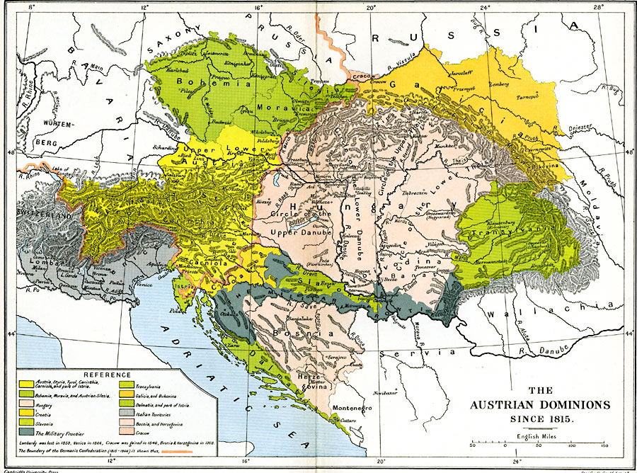
Description: A map showing the Austrian Dominions since the Congress of Vienna (1815) to the acquisition of Bosnia–Herzegovina in 1908. The map is color–coded to show the territories of Austria, Styria, Tyrol, Carinthia, Carniola, Istria, Bohemia, Moravia, Austrian Silesia, Hungary, Croatia, Slavonia, Transylvania, Galicia, Bukovina, Dalmatia, Bosnia, Herzegovina, Cracow, the military frontier, and the Italian territories. The map shows the boundary of the Germanic Confederation of 1815–1866, and notes that Lombardy was lost in 1859, Venice in 1866, Cracow was gained in 1846, and Bosnia–Herzegovina in 1908. The map shows important cities, rivers, and mountain systems of the region.
Place Names: Western and Central Europe, Austria, �Bohemia, �Bosnia,�Croatia, �Dalmatia, �Galicia, �Hungar
ISO Topic Categories: oceans,
location,
inlandWaters,
boundaries
Keywords: The Austrian Dominions, political, country borders,
local jurisdictions,
major political subdivisions, oceans,
location,
inlandWaters,
boundaries, Unknown, 1815 –1908
Source: Ward, Prothero, and Leathes, The Cambridge Modern History Atlas (New York, NY: The Macmillan Company, 1912)
Map Credit: Courtesy the private collection of Roy Winkelman |
|