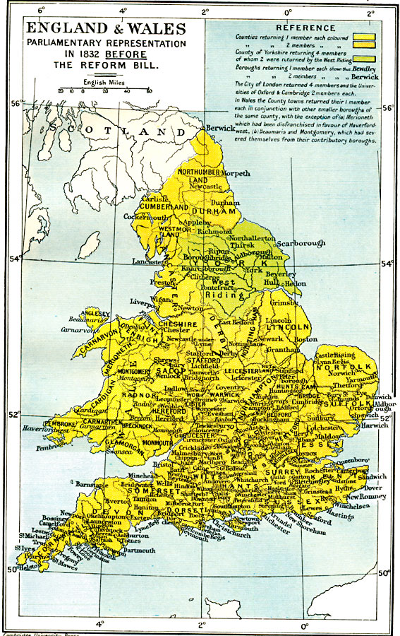
Description: A map of England & Wales, subtitled "Parliamentary Representation in 1832 Before The Reform Bill." The Reform Act made wide–ranging changes in the electoral system in the United Kingdom due, in part, to the growth of large and powerful cities that grew during the Industrial Revolution. This map is color–coded to distinguish between counties returning various numbers of members to Parliament before the Act was passed, with detailed notations.
Place Names: United Kingdom, Bristol, �Dundee, �Edinborough, �Falmouth, �Glasgow, �London, �Londonderry, �Manchester, �Newcastle, �Plymout
ISO Topic Categories: oceans,
location,
inlandWaters,
boundaries
Keywords: England and Wales, political, �historical, country borders,
local jurisdictions,
major political subdivisions, historical event, oceans,
location,
inlandWaters,
boundaries, Unknown, 1832
Source: Ward, Prothero, and Leathes, The Cambridge Modern History Atlas (New York, NY: The Macmillan Company, 1912)
Map Credit: Courtesy the private collection of Roy Winkelman |
|