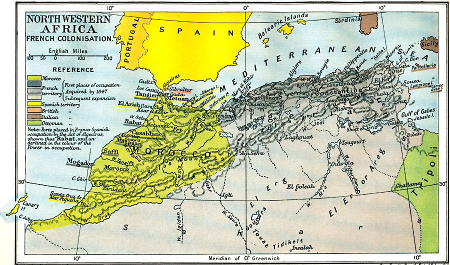
Description: Map of Northwestern Africa, subtitled "French Colonization." This map shows the Barbary States of Morocco, Algeria, and a portion of Ottoman controlled Tripoli. The map is color–coded to show the progression of French occupation in Algeria from territory acquired in 1847 to subsequent expansion. Various other European occupations in the area are shown, including claims on ports by the Spanish, British, and Italians, and land claims of the Ottoman Turks. The map notes those ports placed in Franco–Spanish occupation by the Act of Algeciras with bold type and underlined in the color of the occupying country.
Place Names: A Regional Map of Africa, Algeria, �Mogadon, �Morocco, �Sardinia, �Sicily, �Tripoli, �Tunis, Saffi, Rabat, Tangier, Gibraltar, Tetuan, Fez, Algiers, Gulf of Gabes
ISO Topic Categories: oceans,
location,
inlandWaters,
boundaries
Keywords: Colonization of North Western Africa, political, country borders,
local jurisdictions,
major political subdivisions, oceans,
location,
inlandWaters,
boundaries, Unknown, 1845–1900
Source: Ward, Prothero, and Leathes, The Cambridge Modern History Atlas (New York, NY: The Macmillan Company, 1912)
Map Credit: Courtesy the private collection of Roy Winkelman |
|