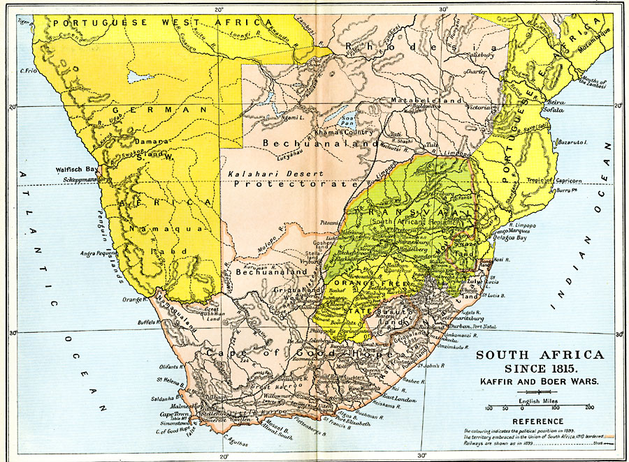
Description: Map of South Africa since 1815 and up to the formation of the Union of South Africa, subtitled "Kaffir and Boer Wars." The map is color–coded to show the political stance in 1899 and the territory embraced in the Union of South Africa in 1910, including British control of Rhodesia, the Cape Colony, Bechuanaland, Basuto, and Natal, the territory of German Southwest Africa, the Transvaal, and Orange Free State, and portions of Portuguese West and East Africa. Major cities and railways are also shown.
Place Names: A Regional Map of Africa, Basutoland, �Bechuanaland, �Capetown, �Damara, �Namaqualand, �Rhodesia, �South Africa, �Transvall, Orange Free State, German Southwest Africa
ISO Topic Categories: oceans,
location,
inlandWaters,
boundaries
Keywords: South Africa, political, �transportation, �historical, country borders,
local jurisdictions,
major political subdivisions, railroads, other military, oceans,
location,
inlandWaters,
boundaries, Unknown, 1815–1910
Source: Ward, Prothero, and Leathes, The Cambridge Modern History Atlas (New York, NY: The Macmillan Company, 1912)
Map Credit: Courtesy the private collection of Roy Winkelman |
|
