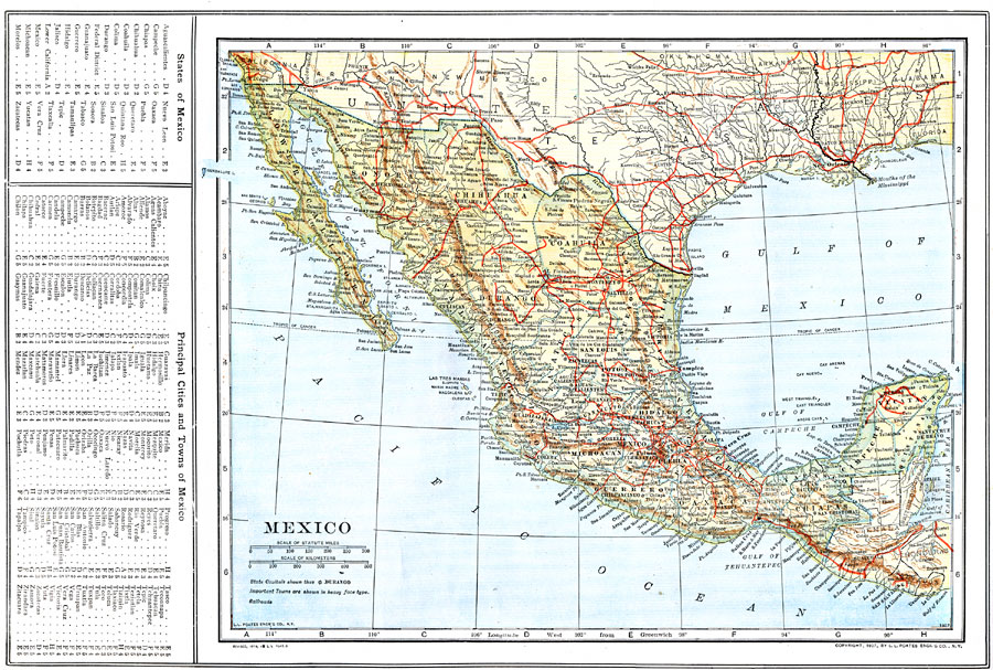
Description: A map from 1914 of Mexico showing the states and state capitals, major cities and towns, railroads, mountains, rivers, lakes, and coastal features of the country. A grid–key in the margin references the locations of states and territories, and principal cities and towns in Mexico.
Place Names: Mexico, Merida, �Veracruz, �Tampico, �Salina Cruz, �Mexico City, �La Paz, �Monterre
ISO Topic Categories: boundaries,
inlandWaters,
location,
oceans,
transportation
Keywords: Mexico, physical, �political, �transportation, physical features, county borders,
country borders, railroads, boundaries,
inlandWaters,
location,
oceans,
transportation, Unknown, 1914
Source: , The New Encyclopedic Atlas and Gazetteer of the World (New York, NY: P. F. Collier and Son, 1914) 63
Map Credit: Courtesy the private collection of Roy Winkelman |
|