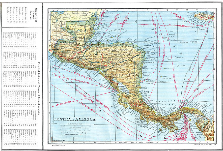
Description: A map from 1914 of Central America showing political boundaries at the time, capitals and major cities, railroads, steamship routes with distances between major ports given in nautical miles, submarine telegraph cables, mountain systems and terrain, lakes, rivers, coastal features, banks or reefs, and the island of Jamaica. The map includes the countries of British Honduras (Belize), Guatemala, Salvador, Honduras, Nicaragua, Zelaya (the Mosquito Reservation), Costa Rica, and Panama with the Canal Zone. A grid key at the left margin of the map helps to locate the countries and principal cities and towns for the region.
Place Names: A Regional Map of North America, Guatemala, �British Honduras, �Honduras, �Salvador, �Nicaragua, �Costa Rica, �Panama,
ISO Topic Categories: boundaries,
location,
inlandWaters,
oceans,
transportation
Keywords: Central America, physical, �political, �transportation, kCentralAmerica, physical features, country borders, water routes,
railroads, boundaries,
location,
inlandWaters,
oceans,
transportation, Unknown, 1914
Source: , The New Encyclopedic Atlas and Gazetteer of the World (New York, NY: P. F. Collier and Son, 1914) 64
Map Credit: Courtesy the private collection of Roy Winkelman |
|