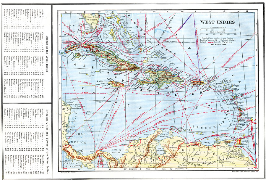
Description: A map from 1914 of the West Indies and the Bahama Island group, showing capitals, major cities, towns and ports, railroads, main steamship routes, submarine telegraph routes, terrain, and coastal features. The foreign possessions in the region are indicated. A grid–key along the left margin of the map help locate the islands and principal cities in the region.
Place Names: A Regional Map of North America, Bahamas, �Cuba, �Haiti, �Porto Rico, �Santo Domingo, �Greater Antilles, �Lesser Antilles, �Windward Islands, �Leeward Islands, �Jamaica,
ISO Topic Categories: boundaries,
inlandWaters,
location,
oceans,
transportation
Keywords: West Indies, physical, �political, �transportation, kCaribbean, physical features, country borders, railroads,
water routes, boundaries,
inlandWaters,
location,
oceans,
transportation, Unknown, 1914
Source: , The New Encyclopedic Atlas and Gazetteer of the World (New York, NY: P. F. Collier and Son, 1914) 65
Map Credit: Courtesy the private collection of Roy Winkelman |
|