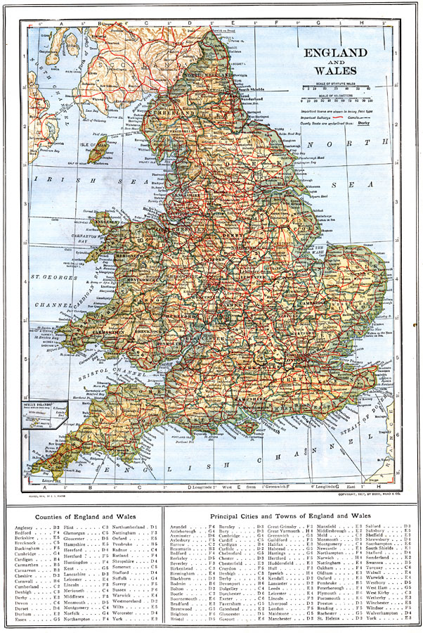
Description: A map of England, Wales, and the southern portion of Scotland in 1914, showing counties, major cities and towns, railroad and canal routes, submarine cables, rivers, and terrain. This map includes an insert of the Scilly Islands, and a reference key to counties, principal cities, and towns.
Place Names: United Kingdom,
ISO Topic Categories: boundaries,
inlandWaters,
location,
oceans,
transportation
Keywords: England and Wales, physical, �political, �transportation, physical features, country borders,
county borders, railroads,
water routes, boundaries,
inlandWaters,
location,
oceans,
transportation, Unknown, 1914
Source: , The New Encyclopedic Atlas and Gazetteer of the World (New York, New York: P. F. Collier and Son, 1914) 67
Map Credit: Courtesy the private collection of Roy Winkelman |
|