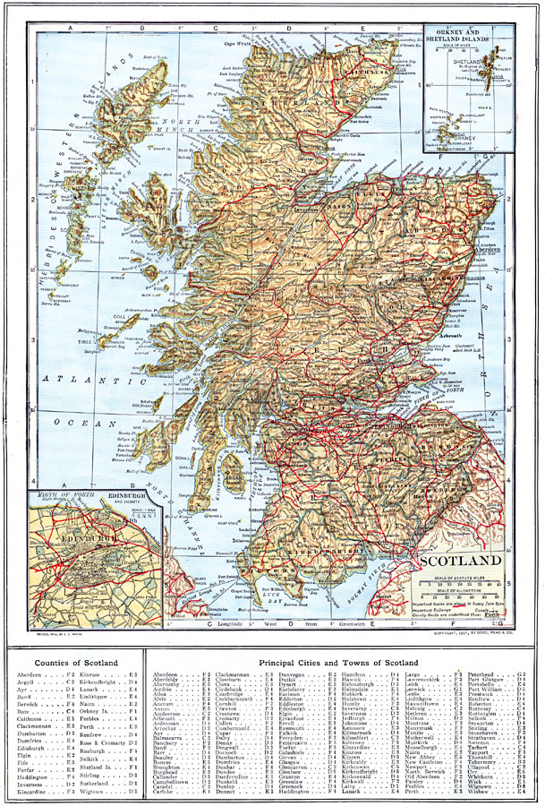
Description: A map of Scotland from 1914, showing counties (names of county boroughs are underlined), major cities and towns, railroad and canal routes, rivers, lakes, terrain, and coastal features. There are insert maps of Edinburgh and the Orkney and Shetland Islands. This map has a reference key to the counties, and principal cities and towns of Scotland.
Place Names: United Kingdom, Edinborough, �Glasgow, �Dundee, �New Castleton, �Leith, �Aberdeen, �Hebrides Islands, �Western Islands, �Isle of Sky,
ISO Topic Categories: boundaries,
inlandWaters,
location,
oceans,
transportation
Keywords: Scotland, physical, �political, �transportation, physical features, county borders, railroads,
water routes, boundaries,
inlandWaters,
location,
oceans,
transportation, Unknown, 1914
Source: , The New Encyclopedic Atlas and Gazetteer of the World (New York, New York: P. F. Collier and Son, 1914) 68
Map Credit: Courtesy the private collection of Roy Winkelman |
|