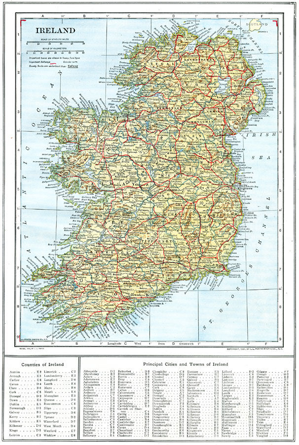
Description: A map of Ireland in 1914 showing major cities, ports, railroads, canals, rivers, and coastal features. This map has a reference key to the Irish counties, cities, and towns.
Place Names: Ireland, Londonderry, �Dublin, �Cork, �Galway, �Killarney, �Limerick, �Monaghan, �Slig
ISO Topic Categories: boundaries,
inlandWaters,
location,
oceans,
transportation
Keywords: Ireland, physical, �political, �transportation, physical features, county borders, railroads,
water routes, boundaries,
inlandWaters,
location,
oceans,
transportation, Unknown, 1914
Source: , The New Encyclopedic Atlas and Gazetteer of the World (New York, New York: P. F. Collier and Son, 1914) 69
Map Credit: Courtesy the private collection of Roy Winkelman |
|