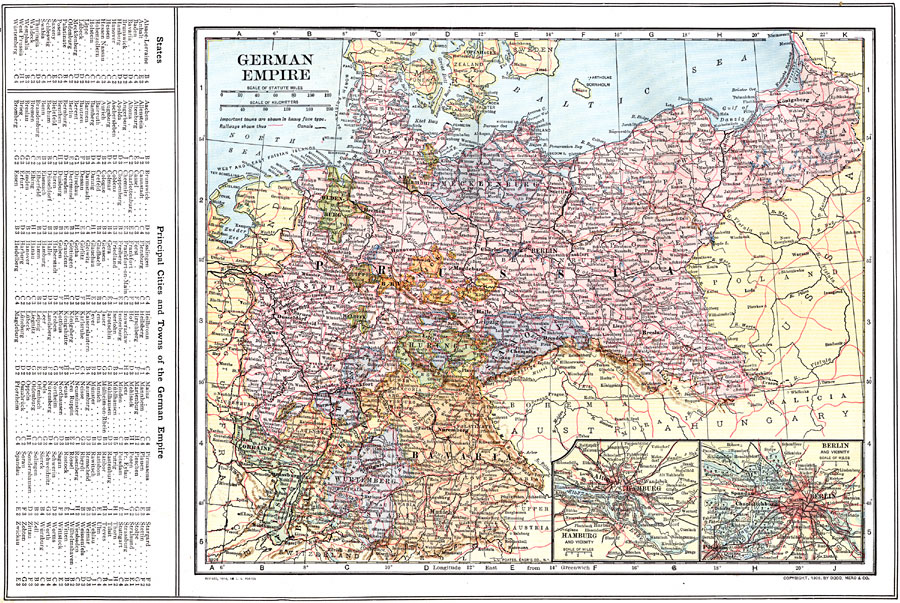
Description: A map of the German Empire in 1914, showing cities, ports, and towns, railroads, canal routes, and rivers. This map includes inserts of the Hamburg and the Berlin vicinity, and a reference key to the German States, and principal cities and town of the German Empire.
Place Names: Germany, Hamburg, �Berlin, �Bremen, �Cologne, �Dresden, �Frankfurt am Main, �Hannover, �Mannheim, �Nuremberg, �Wiesbade
ISO Topic Categories: boundaries,
inlandWaters,
location,
oceans,
transportation
Keywords: German Empire, physical, �political, �transportation, physical features, county borders,
country borders, railroads,
water routes, boundaries,
inlandWaters,
location,
oceans,
transportation, Unknown, 1914
Source: , The New Encyclopedic Atlas and Gazetteer of the World (New York, New York: P. F. Collier and Son, 1914) 73
Map Credit: Courtesy the private collection of Roy Winkelman |
|