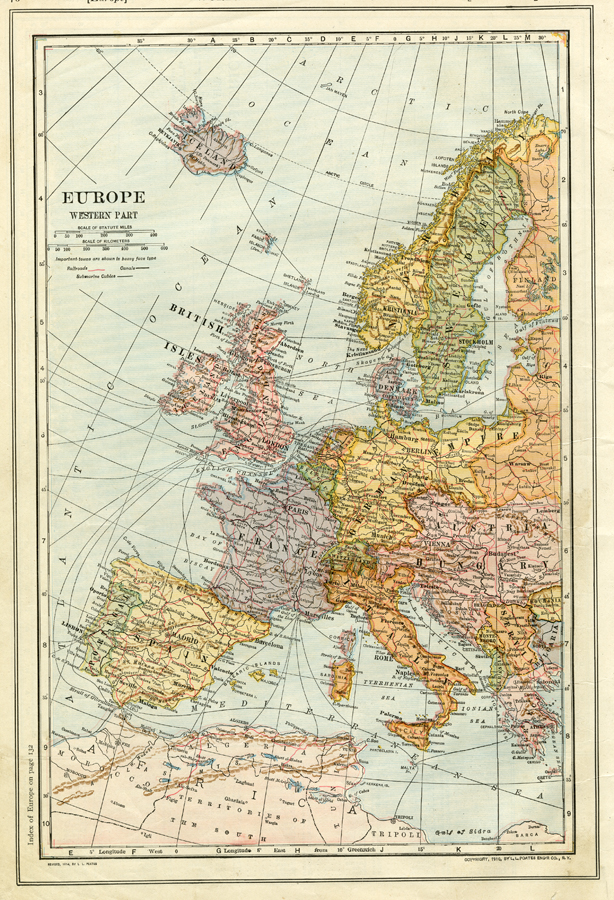
Description: A map from 1914 of the western part of Europe showing the political boundaries of the time, principal cities and towns, railroads, submarine cables, and canal routes.
Place Names: Western and Central Europe, France, �Germany, �Italy, �Portugal, �Spain, �United Kingdom, �Sweden, �Greece, �Romania, �Iceland, �German Empire, �Belgium, �Netherlands, �Austria-Hungary, �Servia, �Albania, �Norway, �Finland, �Switzerland, �Montenegro,
ISO Topic Categories: boundaries,
inlandWaters,
location,
oceans,
transportation
Keywords: Western Europe, physical, �political, �transportation, physical features, country borders, railroads,
water routes, boundaries,
inlandWaters,
location,
oceans,
transportation, Unknown, 1914
Source: , The New Encyclopedic Atlas and Gazetteer of the World (New York, NY: P. F. Collier and Son, 1914) 76
Map Credit: Courtesy the private collection of Roy Winkelman |
|