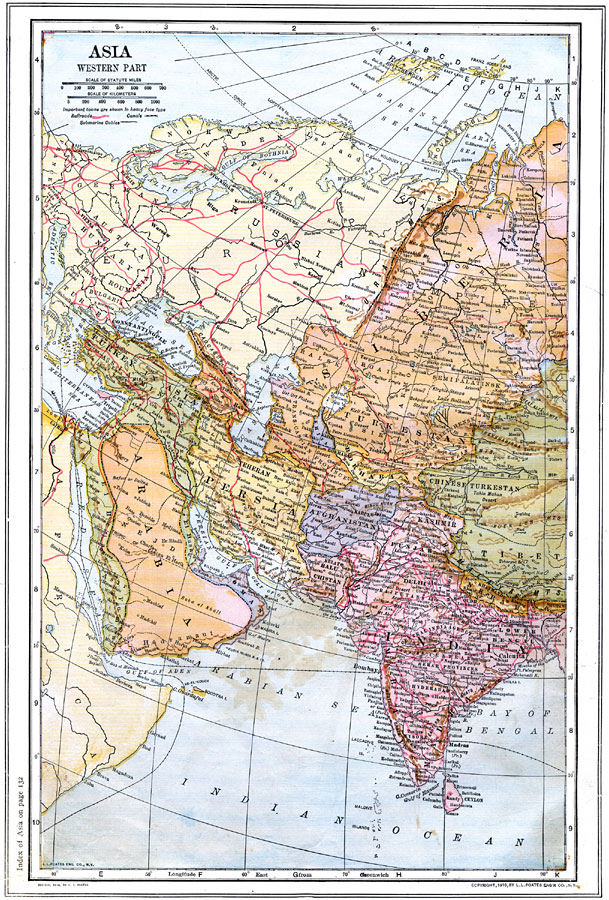
Description: A map from 1914 of the western portion of Asia, including western Siberia and Russian Turkestan, Turkey in Asia, the Arabian Peninsula, Oman, Persia, Afghanistan, portions of Chinese Turkestan and Tibet, Nepal, and the British possessions in India from Baluchistan to Bengal. The map shows the political borders at the time, capitals and major cities, ports, railroads, including connections to the European railway network, canals, submarine telegraph cable routes, terrain, rivers, and coastal features of the region.
Place Names: Miscellaneous Asia, India, �China, �Turkey, �Arabia, �Asia Minor, �Persia, �Siberia, �Turkestan, �Afghanistan, �Oman, �Bokhara, �Kashmir, �Chinese Turkestan, �Nepal, ��Russi
ISO Topic Categories: boundaries,
inlandWaters,
location,
oceans,
transportation
Keywords: Western Asia, physical, �political, �transportation, physical features, country borders, railroads,
water routes, boundaries,
inlandWaters,
location,
oceans,
transportation, Unknown, 1914
Source: , The New Encyclopedic Atlas and Gazetteer of the World (New York, NY: P. F. Collier and Son, 1914) 78
Map Credit: Courtesy the private collection of Roy Winkelman |
|