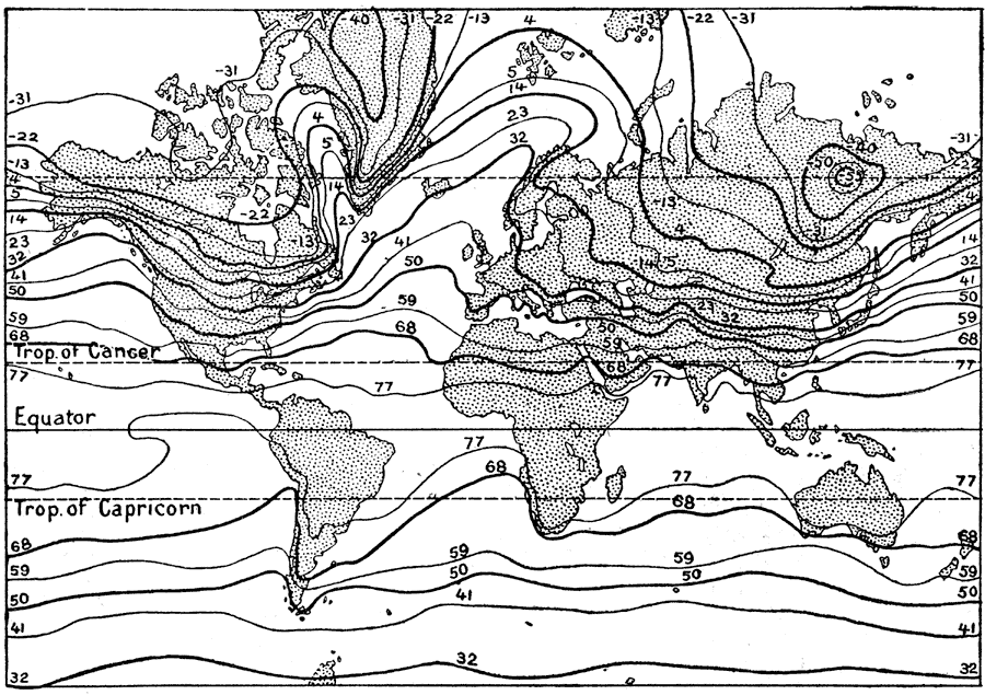
Description: A world map from 1914 showing isotherm lines and illustrating regional temperatures of the world in January. The map shows lines of mean constant air temperatures in 9° Fahrenheit increments across the globe.
Place Names: A Complete Map of Globes and Multi-continent, Africa, �Antarctica, �Asia, �Australia, �Europe, �North America, �South Americ
ISO Topic Categories: climatologyMeteorologyAtmosphere,
location,
inlandWaters,
oceans
Keywords: World Isothermal Lines in January, meteorological, kClimate, climate,
temperature, climatologyMeteorologyAtmosphere,
location,
inlandWaters,
oceans, Unknown, 1914
Source: , The New Encyclopedic Atlas and Gazetteer of the World (New York, New York: P. F. Collier and Son, 1914) 88
Map Credit: Courtesy the private collection of Roy Winkelman |
|