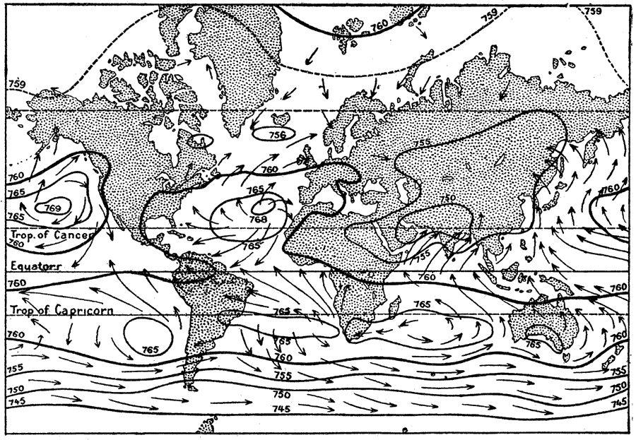
Description: A world map from 1914 showing isobar lines illustrating regional barometric pressure of the world in July. The map shows lines of mean constant pressure in millibars at sea level, and the resulting seasonal prevailing wind directions showing movement from high pressure areas toward areas of low pressure.
Place Names: A Complete Map of Globes and Multi-continent, Africa, �Antarctica, �Asia, �Australia, �Europe, �North America, �South Americ
ISO Topic Categories: climatologyMeteorologyAtmosphere,
inlandWaters,
location,
oceans
Keywords: World Isobaric Lines in July, meteorological, kClimate, climate, climatologyMeteorologyAtmosphere,
inlandWaters,
location,
oceans, Unknown, 1914
Source: , The New Encyclopedic Atlas and Gazetteer of the World (New York, New York: P. F. Collier and Son, 1914) 88
Map Credit: Courtesy the private collection of Roy Winkelman |
|