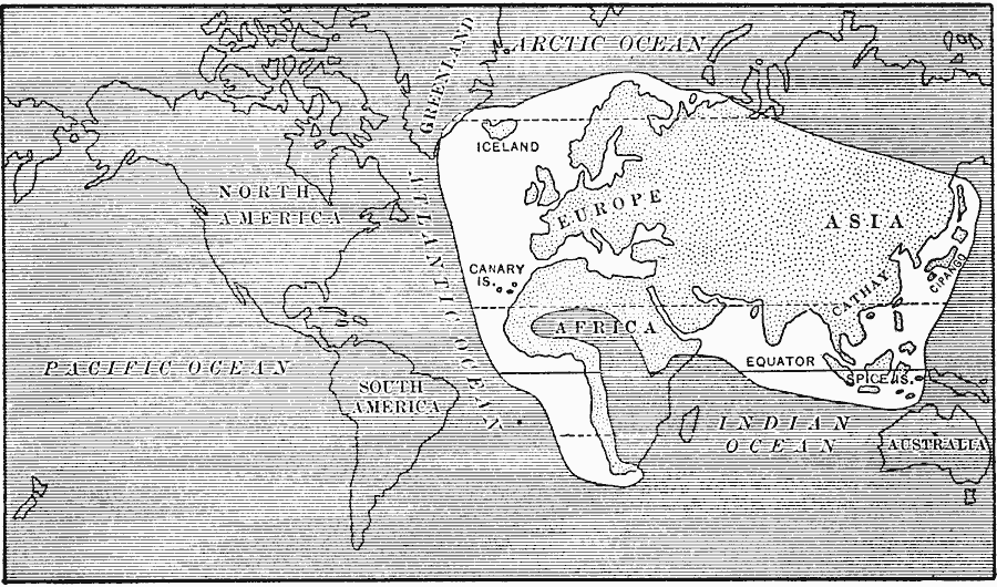
Description: A map from 1911 showing the part of the world (shown in white) known to Europeans when Columbus sailed in 1492. The map shows Europe, northern Africa, including the west coast of Africa explored by the Portuguese, the southern portion of Greenland explored by the Norse, and Columbus' ultimate goal, Asia.
Place Names: A Complete Map of Globes and Multi-continent, Africa, �Asia, �Europe, �Canary Islands, �Spice Island
ISO Topic Categories: oceans,
location,
inlandWaters
Keywords: The World as known in the time of Columbus, physical, country borders, oceans,
location,
inlandWaters, Unknown, 1450–1492
Source: Jacques W. Redway, F.R.G.S., The Redway School History (New York, NY: Silver, Burdett and Company, 1911) 6
Map Credit: Courtesy the private collection of Roy Winkelman |
|