mapsMaps ETC Site map
 Maps ETC > Globes and Multi-continent > Regional Atlantic Ocean > The Lines of Demarcation, and the Routes of Columbus's Voyages, 1492–1504
Site Map 

The Lines of Demarcation, and the Routes of Columbus's Voyages, 1492–1504

The Lines of Demarcation, and the Routes of Columbus's Voyages


Title: The Lines of Demarcation, and the Routes of Columbus's Voyages
Projection: Unknown,
Source Bounding Coordinates:
W: E: N: S:

Main Map Page
Zoomify Version
B/W PDF Version
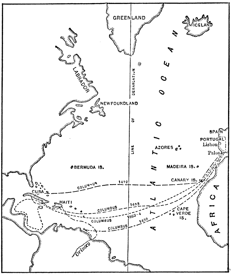
Description: Map showing The Lines of Demarcation, and the Routes of Columbus's Voyages.
Place Names: Regional Atlantic Ocean, Africa, Greenland, Iceland, North America, Portugal, South America, Spai
ISO Topic Categories: physical, transportation, kWorldAtlantic, kWorldAmericas
Keywords: The Lines of Demarcation, and the Routes of Columbus's Voyages, physical, transportation, country borders, water routes, physical, transportation, kWorldAtlantic, kWorldAmericas, Unknown, 1492–1504
Source: Jacques W. Redway, F.R.G.S., The Redway School History (New York, NY: Silver, Burdett and Company, 1911) 11
Map Credit: Courtesy the private collection of Roy Winkelman
SearchLicensePDF HelpGIS Help Google Earth Help Zoomify Help

 Maps ETC > Globes and Multi-continent > Regional Atlantic Ocean > The Lines of Demarcation, and the Routes of Columbus's Voyages, 1492–1504
Site Map