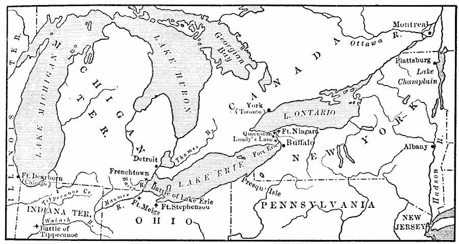
Description: A map of the Great Lakes Region of North America to the Hudson River showing the northern area of conflict during the War of 1812, including the important sites of Fort Dearborn (Chicago), Battle of Tippecanoe, Detroit, Frenchtown (River Raisin Massacre), Battle of Lake Erie, Fort Meigs, Fort Stephenson, Presqu' Isle (Erie), Buffalo, Lundy's Lane, Queenstown, Fort Niagara, York (Toronto), Montreal, Plattsburg on Lake Champlain, and Albany.
Place Names: A Regional Map of North America, Canada, �Montreal, �New Jersey, �New York, �Ohio, �Pennsylvania, �Quebec, �Toronto, �United State
ISO Topic Categories: oceans,
location,
inlandWaters
Keywords: Scene of Operations in the War of 1812, historical, other military, oceans,
location,
inlandWaters, Unknown, 1812–1815
Source: Jacques W. Redway, F.R.G.S., The Redway School History (New York, NY: Silver, Burdett and Company, 1911) 221
Map Credit: Courtesy the private collection of Roy Winkelman |
|