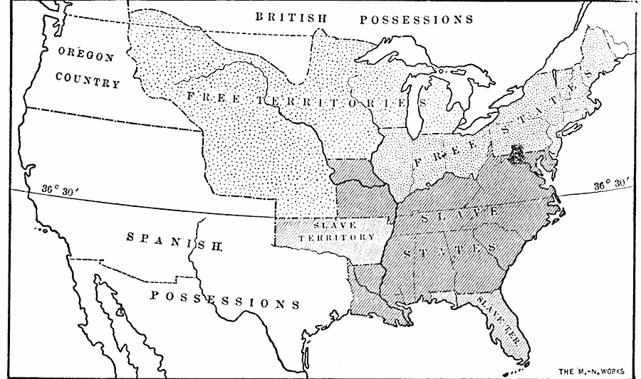
Description: A map of the United States at the time of the Missouri Compromise (1820) showing the free states and territories, slave states and territories, the British and Spanish possessions at the time, and the Oregon Country.
Place Names: A Complete Map of the United States, Missouri Compromise, �free states, �slave states, �Slaver
ISO Topic Categories: oceans,
location,
inlandWaters
Keywords: Slave and Free Areas after the Missouri Compromise, historical, historical event, oceans,
location,
inlandWaters, Unknown, 1820
Source: Jacques W. Redway, F.R.G.S., The Redway School History (New York, NY: Silver, Burdett and Company, 1911) 250
Map Credit: Courtesy the private collection of Roy Winkelman |
|
