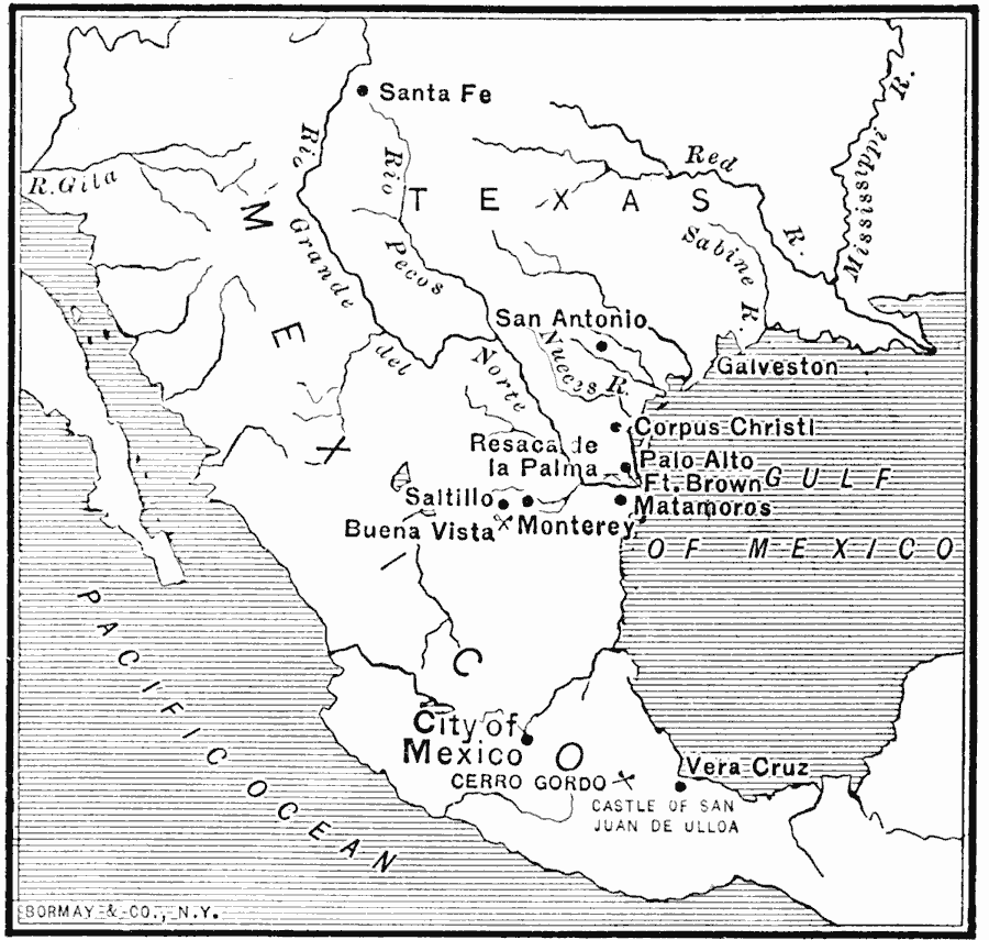
Description: A map of central Mexico and southern United States showing the important cities and battle sites of the Mexican–American War (1846–1848). The map shows the rivers of the contested boundaries that led to the war, the Rio Grande del Norte (Texas claim) and the Sabine River (Mexican claim), which was the boundary established by the Louisiana Purchase of 1803. This map shows the battle sites of Buena Vista and Cerro Gordo.
Place Names: A Regional Map of North America, Mexico, �Texas, �United State
ISO Topic Categories: oceans,
location,
inlandWaters
Keywords: The Mexican War, political, �historical, country borders, other military, oceans,
location,
inlandWaters, Unknown, 1846–1848
Source: Jacques W. Redway, F.R.G.S., The Redway School History (New York, NY: Silver, Burdett and Company, 1911) 277
Map Credit: Courtesy the private collection of Roy Winkelman |
|