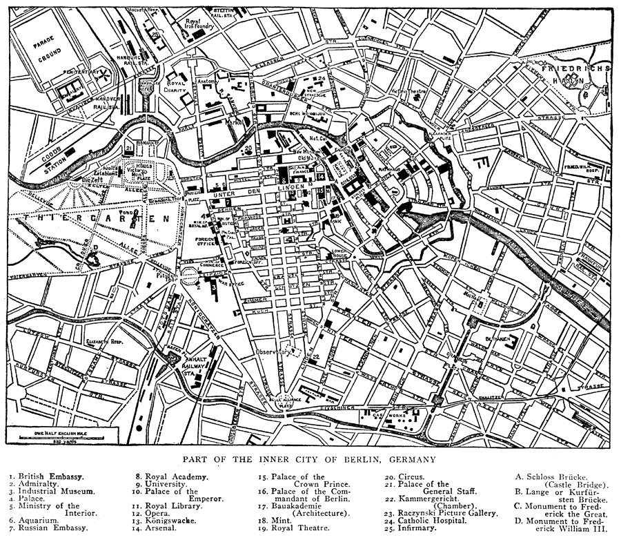
Description: A map of Berlin, Germany in 1914, showing the inner city with major streets, canals and the River Spree, and a numbered reference key to embassies, museums, theaters, hospitals, monuments, and historical landmarks.
Place Names: Germany, Berlin, �River Spree,
ISO Topic Categories: inlandWaters,
transportation,
structure
Keywords: Street Map of Berlin, Germany, physical, �transportation, physical features, water routes,
roads,
railroads, inlandWaters,
transportation,
structure, Unknown, 1914
Source: , The New Encyclopedic Atlas and Gazetteer of the World (New York, New York: P. F. Collier and Son, 1914) 152
Map Credit: Courtesy the private collection of Roy Winkelman |
|