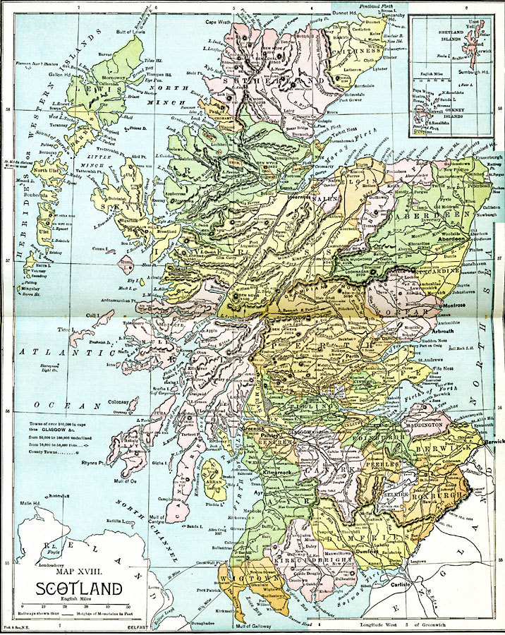
Description: A map of Scotland from 1885, showing major cities, towns, railroads, rivers, lakes, terrain, and coastal features. An inset map shows the Orkney and Shetland islands. Mountain elevations are shown in feet, and the ferry distances to Ireland are shown in miles. The general populations of cities and towns are shown, with towns of over 100,000 shown with bold caps, 50,000 to 100,000 shown underlined, and 10,000 to 50,000 with an open circle symbol. County towns are shown with a filled circle symbol.
Place Names: United Kingdom, Kilmarnock, �Dumfries, �Berwick, �Edinburgh, �Glasgow, �Paisley, �Greenock, �Arbroath, �Montrose, �Aberdeen, �Invernes
ISO Topic Categories: boundaries,
inlandWaters,
location,
oceans,
transportation
Keywords: Scotland, physical, �transportation, �political, physical features,
topographical, country borders,
major political subdivisions, railroads, boundaries,
inlandWaters,
location,
oceans,
transportation, Unknown, 1885
Source: John Clark Ridpath LL. D., Cyclopedia of Universal History (Cincinnati, Ohio: Jones Brothers Publishing Co., 1885) 758-759
Map Credit: Courtesy the private collection of Roy Winkelman |
|