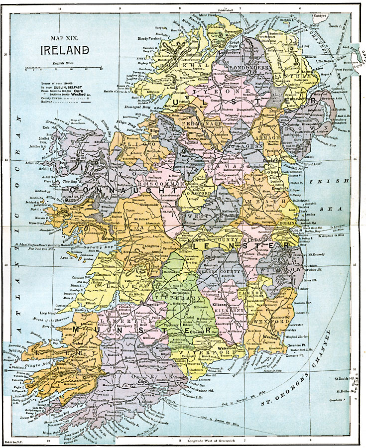
Description: A map of Ireland in 1885 showing the four provinces of Ireland (Ulster, Connaught, Leinster, and Munster) and is color–coded to show the counties of each province. This map shows, major cities and county capitals, ports, rivers, lakes and terrain, railways, and shipping routes with mileage between major ports.
Place Names: Ireland, Cork, �Waterford, �Wexford, �Limerick, �Galway, �Sligo, �Londonderry, �Dundalk, �Drogheda, �Dublin, �Kilkenn
ISO Topic Categories: boundaries,
inlandWaters,
location,
oceans,
transportation
Keywords: Ireland, physical, �political, �transportation, physical features, country borders,
major political subdivisions, railroads, boundaries,
inlandWaters,
location,
oceans,
transportation, Unknown, 1885
Source: John Clark Ridpath LL. D., Cyclopedia of Universal History (Cincinnati, Ohio: Jones Brothers Publishing Co., 1885) 786-787
Map Credit: Courtesy the private collection of Roy Winkelman |
|