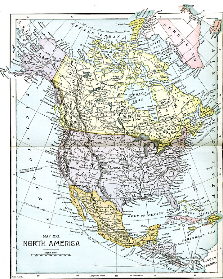
Description: A map from 1885 of North America, Central America, Greenland, and the Caribbean showing political boundaries at the time, major cities, mountain systems, lakes, rivers, and coastal features of the region. Ship routes from San Francisco and New York are shown to the Panama isthmus, Europe, and China with miles given in nautical miles.
Place Names: A Complete Map of North America, Bahamas, �Canada, �Mexico, �Cuba, �United State
ISO Topic Categories: boundaries,
inlandWaters,
location,
oceans
Keywords: North America, physical, �political, physical features, country borders, boundaries,
inlandWaters,
location,
oceans, Unknown, 1885
Source: John Clark Ridpath LL. D., Cyclopedia of Universal History (Cincinnati, OH: Jones Brothers Publishing Co., 1885) 1128-1129
Map Credit: Courtesy the private collection of Roy Winkelman |
|