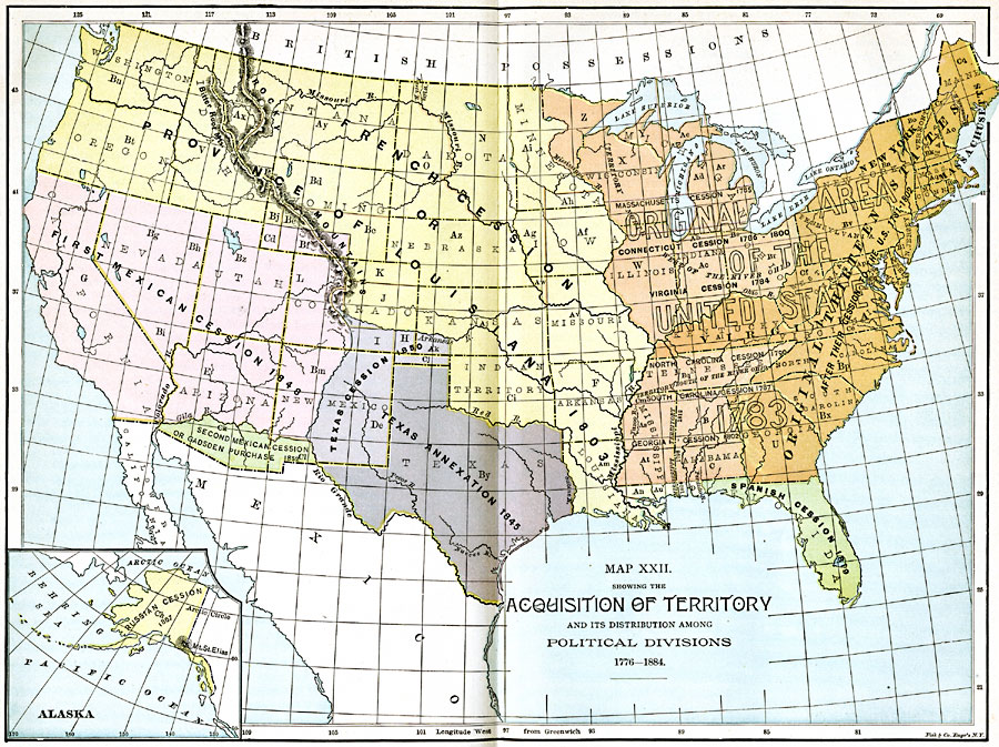
Description: A map from 1885 of the United States showing the territorial growth from the original States and the Northwest Territory in 1783 to the Russian cession of Alaska in 1867. The map is color–coded to show the progression from the original thirteen States, the territories north of the Ohio River and south of Virginia's claim, the French cession or Province of Louisiana (on this map includes the Oregon Country) in 1803, Spanish cession of Florida in 1819, Texas annexation in 1845 and cession in 1850, the first Mexican cession in 1848, second Mexican cession or Gadsden Purchase in 1853, and includes an inset map showing the Russian cession in 1867.
Place Names: Growth of Nation, Original Thirteen States, �Spanish Cession, �French Cession, �Texas Annexation, �Texas Cession, �First Mexican Cession, �Gadsden Purchase, �Louisiana Purchase, �Original Colonies, �Texa
ISO Topic Categories: boundaries,
location,
inlandWaters,
oceans
Keywords: Acquisition of Territory, physical, �political, �historical, physical features, country borders,
major political subdivisions, historical event, boundaries,
location,
inlandWaters,
oceans, Unknown, 1783–1884
Source: John Clark Ridpath LL. D., Cyclopedia of Universal History (Cincinnati, OH: Jones Brothers Publishing Co., 1885) 1188-1189
Map Credit: Courtesy the private collection of Roy Winkelman |
|