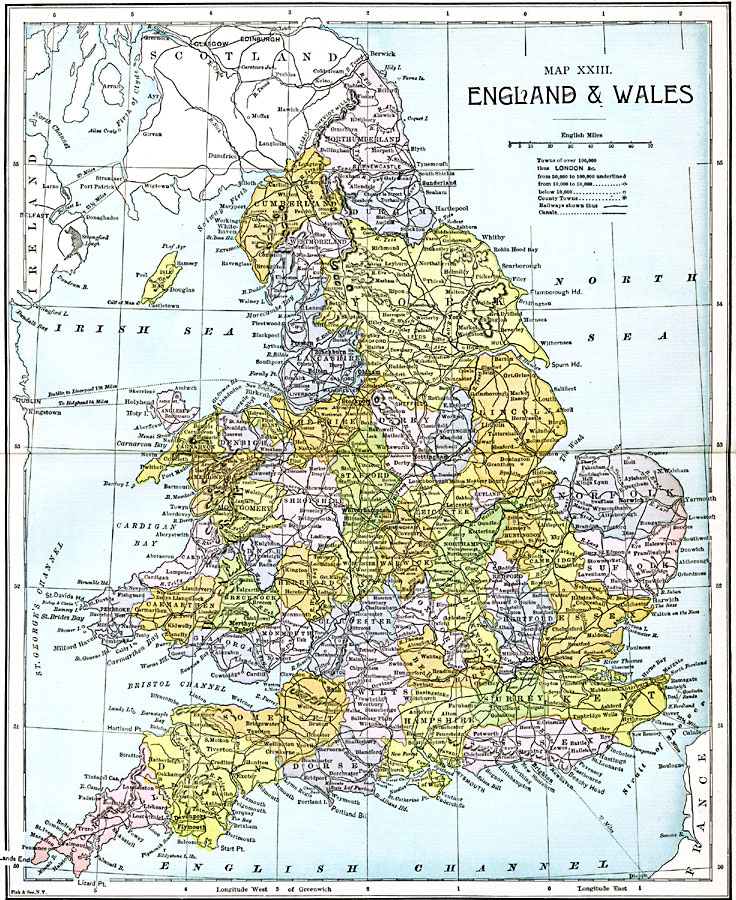
Description: A map of England and Wales from 1885, showing counties, all cities and towns with a population over 100,000 at the time, railways and canals, ferry routes across the Strait of Dover, North Channel, and Irish Sea (with distance between ports in miles), rivers, terrain, and coastal features.
Place Names: United Kingdom, Devonport, �Plymouth, �Portsmouth, �Brighton, �Dover, �Foulness, �London, �Merthyr, �Tydvil, �Liverpool, �Stockport, �Wolverhampton, �Bedford, �Hull, �Sunderlan
ISO Topic Categories: boundaries,
inlandWaters,
location,
oceans,
transportation
Keywords: England and Wales, physical, �political, �transportation, physical features, major political subdivisions, railroads,
water routes, boundaries,
inlandWaters,
location,
oceans,
transportation, Unknown, 1885
Source: John Clark Ridpath LL. D., Cyclopedia of Universal History (Cincinnati, Ohio: Jones Brothers Publishing Co., 1885) 1202-1203
Map Credit: Courtesy the private collection of Roy Winkelman |
|