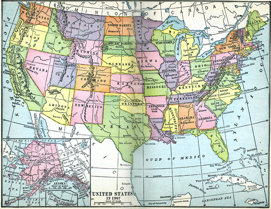
Description: A map from 1907 of the ‘lower forty–eight’ United States showing state boundaries and state capitals, major cities and towns, mountain systems, lakes, rivers, and coastal features. An inset map details Alaska.
Place Names: A Complete Map of the United States, Boston, �Chicago, �Houston, �Los Angeles, �Miami, �New Orleans, �New York, �San Diego, �Seattle, �Washington D.C
ISO Topic Categories: oceans,
location,
inlandWaters
Keywords: United States, borders, �physical, physical features, oceans,
location,
inlandWaters, Unknown, 1907
Source: Jacques W. Redway, F.R.G.S., The Redway School History (New York, NY: Silver, Burdett and Company, 1911)
Map Credit: Courtesy the private collection of Roy Winkelman |
|