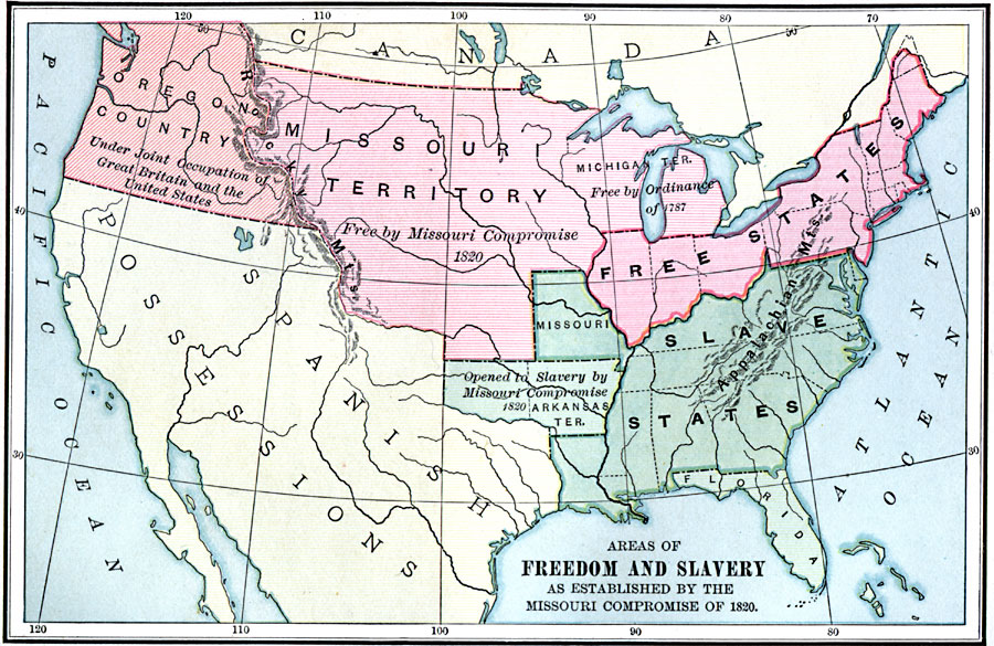
Description: A map of the United States and territories showing the free areas and areas open to slavery as established by the Missouri Compromise of 1820.
Place Names: Growth of Nation, Free States, �Slavery,
ISO Topic Categories: boundaries,
oceans,
inlandWaters,
location
Keywords: Freedom and Slavery, physical, �political, physical features, country borders,
major political subdivisions, boundaries,
oceans,
inlandWaters,
location, Unknown, 1820
Source: Charles Kendall Adams, A History of the United States (Boston, MA: Allyn and Bacon, 1909) 251
Map Credit: Courtesy the private collection of Roy Winkelman |
|