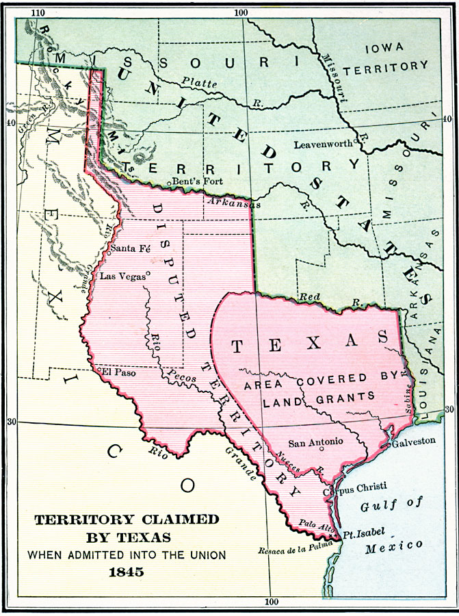
Description: A map of territory claimed by Texas when admitted into the Union, 1845. The map is color–coded to show the frontiers of Texas with the United States and Mexico, the territory in the east covered under the old Spanish land grants, and the disputed territory in the west between the Rio Grande and Nueces rivers and north to the Arkansas River.
Place Names: Growth of Nation, El Paso, �Las Vegas, �Santa Fe, �San Antonio, �Palo Alto, �Galveston, �Texas, �Mexican Cessio
ISO Topic Categories:
Keywords: Territory Claimed by Texas, physical, �political, �historical, �Mexican-American War, physical features, country borders,
major political subdivisions, other military, Unknown, 1845
Source: Charles Kendall Adams, A History of the United States (Boston, MA: Allyn and Bacon, 1909) 296
Map Credit: Courtesy the private collection of Roy Winkelman |
|