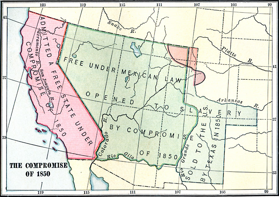
Description: A map of California and the western territories at the time of the Compromise of 1850. The compromise was a series of bills dealing with the slavery issue, and under its provisions California was admitted to the Union as a free state, New Mexico and Utah were organized with no restrictions or conditions in regard to slavery, and Texas was to receive the price she demanded for the land ceded to New Mexico.
Place Names: Growth of Nation, California, �Texas, �Second Mexican Cessio
ISO Topic Categories: boundaries,
location,
oceans,
inlandWaters
Keywords: Compromise of 1850, physical, �political, �historical, �Compromise of 1850, physical features, country borders,
major political subdivisions, historical event, boundaries,
location,
oceans,
inlandWaters, Unknown, 1850
Source: Charles Kendall Adams, A History of the United States (Boston, MA: Allyn and Bacon, 1909) 308
Map Credit: Courtesy the private collection of Roy Winkelman |
|