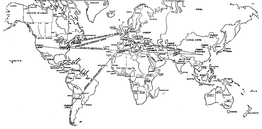
Description: Map of the world, showing the location of hemp cultivation for fiber, oil, and drug, with the sources and dates of introduction.
Place Names: A Complete Map of Globes and Multi-continent, Europe, �Africa, �Asia, �Australia, �North America, �South Americ
ISO Topic Categories: biota,
oceans,
location,
economy
Keywords: Locations of Hemp Cultivation, political, �statistical, �transportation, country borders, agriculture, water routes, biota,
oceans,
location,
economy, Unknown, 1913
Source: United States Department of Agriculture, Yearbook of the United States Department of Agriculture (Washington, D.C., DC: Government Printing Office, 1913)
Map Credit: Courtesy the private collection of Roy Winkelman |
|