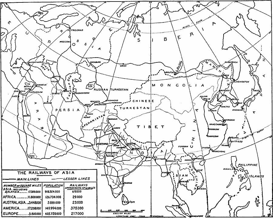
Description: A map from 1919 of the railways networks in Asia at the time, showing trunk or main railways with heavy black lines, and lesser railways with lighter lines. A chart at the bottom of the map shows a comparison of the number of square miles of area, population at the time, and the approximate number of miles of railway for Asia (including Malaysia), Africa, Australasia, America, and Europe. Major cities connected to the railway network are shown.
Place Names: A Complete Map of Asia, China, �India, �Japan, �Mongolia, �Phillipines, �Russia, �Thailand, �French Indochina, �Afghanistan, �Ceylon,�Sri Lanka, �Formosa, �Taiwa
ISO Topic Categories: transportation,
inlandWaters,
location,
oceans,
boundaries
Keywords: The Railways of Asia, physical, �political, �transportation, physical features, country borders, railroads, transportation,
inlandWaters,
location,
oceans,
boundaries, Unknown, 1919
Source: Herbert Adams Gibbons, The New Map of Asia (New York, NY: The Century Co., 1919) 324
Map Credit: Courtesy the private collection of Roy Winkelman |
|