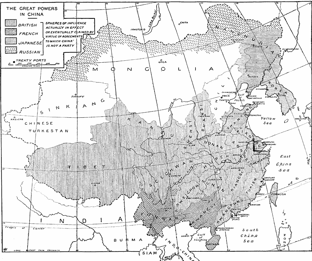
Description: A map of China from 1919 showing the territorial possessions claimed in the country under European and Japanese imperialism after the Treaty of Shimonoseki (1895) between Japan and China, and the Conference of Paris, or Paris Peace Conference (1919) among the Allied victors of World War I. This map shows the spheres of influence of the British, French, Russians, and Japanese actually in effect or eventually claimed by virtue of agreements to which China was not a party. The map shows treaty ports, major cities, and the boundaries of the former districts of China.
Place Names: China, China, �India, �Japan, �Mongolia, �Russia, �Thailand, �Siam, �French Indochina, �Korea, �Fukein, �Yunnan, �Tibet, �Honan, �Manchuria, �Shanghai, �Shantung, �Peking, �Beijing, �Phillipine
ISO Topic Categories: inlandWaters,
location,
oceans,
boundaries
Keywords: The Great Powers and Imperialism in China, physical, physical features, country borders,
major political subdivisions, inlandWaters,
location,
oceans,
boundaries, Unknown, 1919
Source: Herbert Adams Gibbons, The New Map of Asia (New York, NY: The Century Co., 1919) 388
Map Credit: Courtesy the private collection of Roy Winkelman |
|