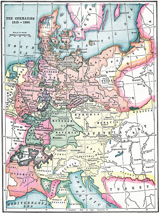
Description: A map of the Germanies, as boundaries existed from 1815 to 1866 under the German Confederation. The map shows the 39 member states, which included portions of Prussian and the Austrian empires, the Duchy of Holstein, Luxemburg, Kingdom of Hanover, Kingdom of Saxony, Kingdom of Bavaria, Baden, Württemberg, Electorate of Hesse, Hesse, the four free cities of Lübeck, Frankfurt, Bremen, and Hamburg, and 23 smaller German states. The map shows major cities and capitals (circled) of the states.
Place Names: Western and Central Europe, Germany, �France, �Turkey, �Piedmont, �Bavaria, �Hanover, �Bohemia, �Switzerland, �Austria, �Denmark, �Sweden, �Prussia, �Hungary, �Wurtemburg, �Saxony, �Westphalia, �Netherlands,
ISO Topic Categories: boundaries,
inlandWaters,
location,
oceans
Keywords: The Germanies, physical, �political, kGermanConfederacy,physical features, country borders,
major political subdivisions, boundaries,
inlandWaters,
location,
oceans, Unknown, 1815–1866
Source: Lucius Hudson Holt, Ph.D., The History of Europe from 1862 to 1914 (New York, NY: The Macmillan Company, 1918) 30
Map Credit: Courtesy the private collection of Roy Winkelman |
|