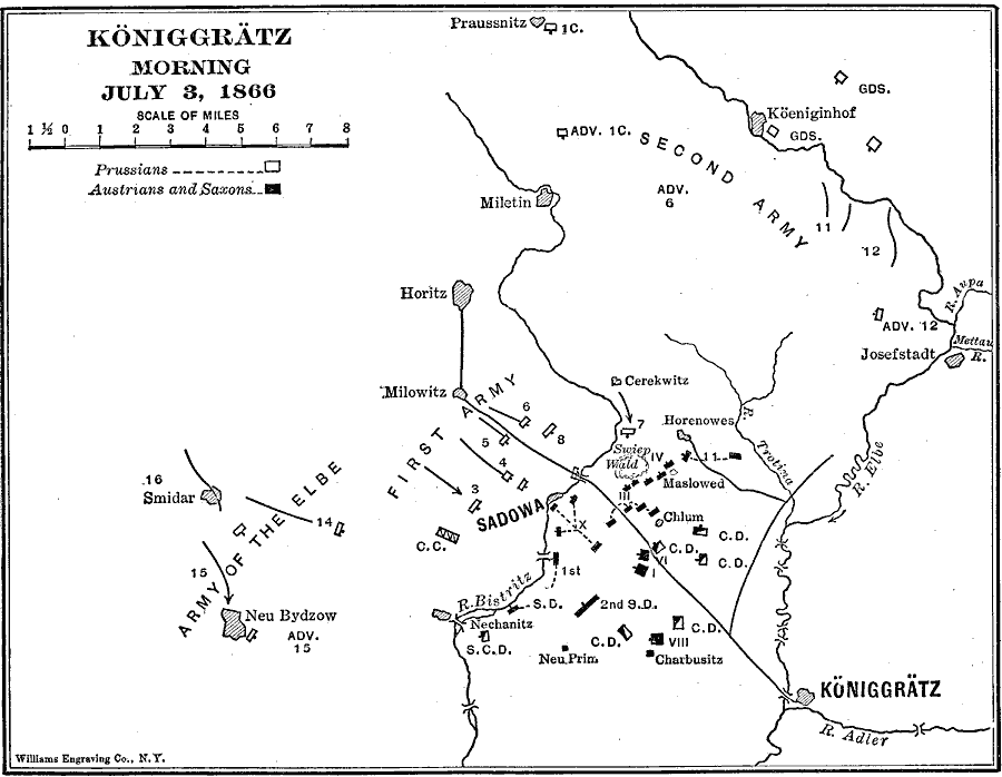
Description: A map of the Bohemian area around Sadowa where the Battle of Königgrätz (or the Battle of Sadowa) was fought during the Austro–Prussian War of 1866. The map shows the military positions of the Prussians and the allied forces of the Austrians and Saxons on the morning of July 3, and the direction of advance by the Prussians, who ultimately won the battle. The map also shows important cities in the area, rivers, and strategic bridges across the Bistritz and Elbe rivers.
Place Names: Germany, Horitz, �Milowitz, �Koniggra
ISO Topic Categories: intelligenceMilitary,
inlandWaters,
location
Keywords: Königgrätz , physical, �political, �historical, �austro-prussian war, kBattle, physical features, local jurisdictions, other military, intelligenceMilitary,
inlandWaters,
location, Unknown, March 7, 1866
Source: Lucius Hudson Holt, Ph.D., The History of Europe from 1862 to 1914 (New York, NY: The Macmillan Company, 1918) 108
Map Credit: Courtesy the private collection of Roy Winkelman |
|