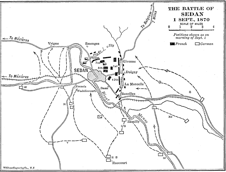
Description: A map of the Battle of Sedan near the border Belgium during the Franco–German War, which took place on September 1, 1870. This battle is noted for the Prussian capture of Napoleon III and his army. This map shows the French and German military positions in the morning, and the German routes of attack. The map also shows cities and towns in the vicinity, the River Meuse, roads and railway.
Place Names: France, Seda
ISO Topic Categories: intelligenceMilitary,
inlandWaters,
location,
transportation
Keywords: The Battle of Sedan, physical, �historical, �franco-german war, �transportation, kBattle, physical features, railroads,
roads, other military, intelligenceMilitary,
inlandWaters,
location,
transportation, Unknown, September 1, 1870
Source: Lucius Hudson Holt, Ph.D., The History of Europe from 1862 to 1914 (New York, NY: The Macmillan Company, 1918) 150
Map Credit: Courtesy the private collection of Roy Winkelman |
|