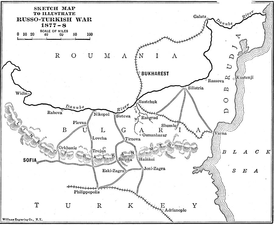
Description: A sketch–map to illustrate the Russo–Turkish War, from 1877 to 1878 in the region south of the Danube River Delta in Roumania and Bulgaria. The map shows strategic railways and roads, terrain such as the Balkan Mountain passes and the Danube, and the important cities of Bukharest, Galatz, Nikopol, Rustchuck, Silistria, Sofia, Philippopolis, and Shipka.
Place Names: Southeastern Europe, Romania, �Turke
ISO Topic Categories: transportation,
location,
oceans,
inlandWaters,
boundaries
Keywords: Russo-Turkish War, physical, �political, �transportation, �historical, �russo-turkish war, physical features, country borders, roads,
railroads, other military, transportation,
location,
oceans,
inlandWaters,
boundaries, Unknown, 1877–1878
Source: Lucius Hudson Holt, Ph.D., The History of Europe from 1862 to 1914 (New York, NY: The Macmillan Company, 1918) 198
Map Credit: Courtesy the private collection of Roy Winkelman |
|