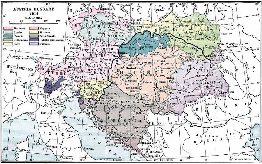
Description: A map showing Austria–Hungary in 1914 and the ethnographic makeup of peoples, including Germans, Czechs, Slovaks, Ruthenians, Poles, Magyars, Slovenes, Serbo–Coates, Italians and Ladins, and Romanians. This map also shows major rivers and cities.
Place Names: Austria-Hungary, Bosnia, �Switzerland, �Tyrol, �Hungary, �Bosnia, �Transylvania, �Bohemia, �Romania, �Ital
ISO Topic Categories: society,
inlandWaters,
location,
oceans,
boundaries
Keywords: Austria-Hungary, physical, �political, �statistical, kEthnic, physical features, country borders, ethnological, society,
inlandWaters,
location,
oceans,
boundaries, Unknown, 1914
Source: Lucius Hudson Holt, Ph.D., The History of Europe from 1862 to 1914 (New York, NY: The Macmillan Company, 1918) 262
Map Credit: Courtesy the private collection of Roy Winkelman |
|