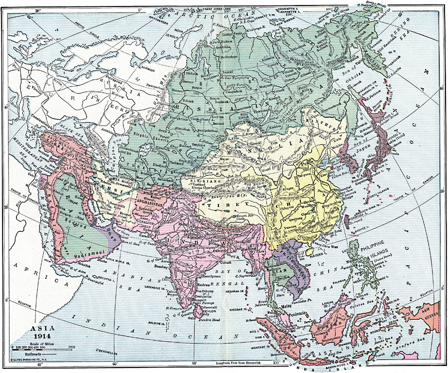
Description: A map of Asia in 1914, showing country boundaries at the time, major cities, railroads, rivers, lakes, terrain, and coastal features. The map illustrates the colonial expansion of the Russian Empire into Asia, Japan into Korea and China, Germany to the Chinese port of Kiaochau, France into Indochina, the extent of the Turkish Ottoman Empire, and the British possessions in India, Burma, and Borneo.
Place Names: A Complete Map of Asia, China, �India, �Indonesia, �Japan, �Thailand, �Russia, �Phillipines, �Mongolia, �French Indochina, �Korea, �Persia,�Chosen, �Arabia, �Ceylon
ISO Topic Categories: boundaries,
inlandWaters,
location,
oceans
Keywords: Colonial Rivalry in Asia, physical, �political, physical features, country borders, boundaries,
inlandWaters,
location,
oceans, Unknown, 1914
Source: Lucius Hudson Holt, Ph.D., The History of Europe from 1862 to 1914 (New York, NY: The Macmillan Company, 1918) 342
Map Credit: Courtesy the private collection of Roy Winkelman |
|