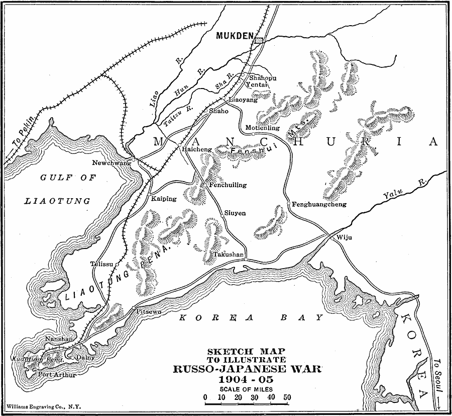
Description: A sketch map of the Liaotung Peninsula in Manchuria, showing the principal area of conflict during the Russo–Japanese War of 1904–1905. This map shows the China Far East Railway between Port Arthur and Mukden, and the spur route to Peking (Beijing), the Fenshui Mountains and other terrain, the Yalu, Liao, Hun, and Taitzu Rivers, coastal features, and the cities of Shahopu, Yentai, Liaoyang, Shaho, Haicheng, Newchwang, Kaiping, Telissu, Nanshan, Dalny, and others.
Place Names: China, Mukden, �Takushan, �Kaiping, �Wiju, �Liaoyan
ISO Topic Categories: boundaries,
inlandWaters,
oceans,
location,
intelligenceMilitary,
transportation
Keywords: Theater of the Russo-Japanese War, physical, �transportation, �historical, �russo-japanese war, physical features, roads,
railroads, other military, boundaries,
inlandWaters,
oceans,
location,
intelligenceMilitary,
transportation, Unknown, 1904–1905
Source: Lucius Hudson Holt, Ph.D., The History of Europe from 1862 to 1914 (New York, NY: The Macmillan Company, 1918) 350
Map Credit: Courtesy the private collection of Roy Winkelman |
|