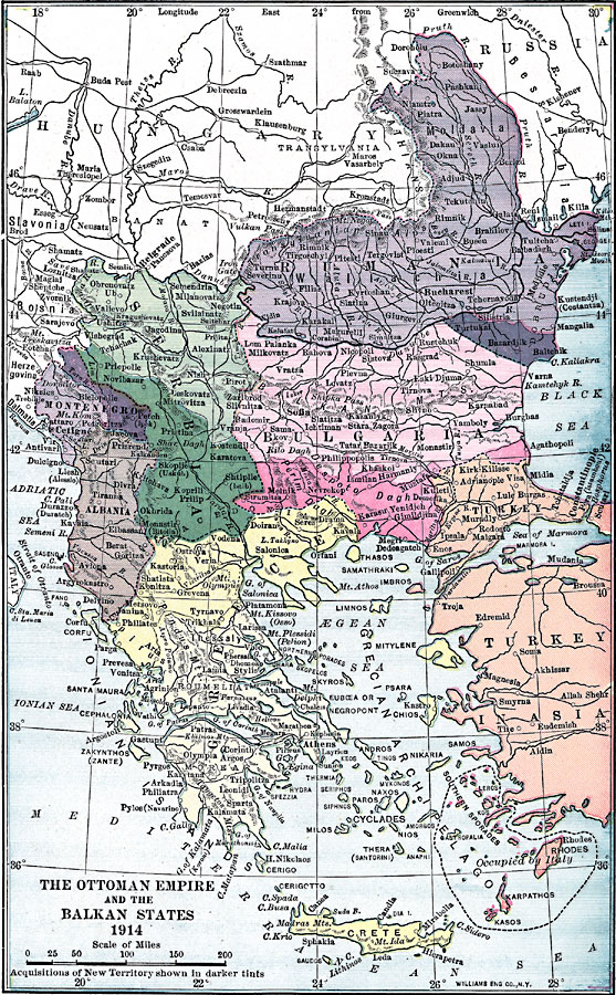
Description: A map from 1914 of the Ottoman Empire in Europe and the Balkan States at the time it joined the Central Powers to form the Triple Alliance. The map is color–coded to show the acquisitions of new territories by the Turks, and shows the islands of the Southern Sporades and Karpathos under Italian occupation. The map shows major cities, railways, rivers, and coastal features.
Place Names: Southeastern Europe, Turkey, �Romania, �Bulgaria, �Crete, �Greece, �Serbia, �Albania, �Montenegr
ISO Topic Categories: transportation,
location,
inlandWaters,
boundaries
Keywords: Ottoman Empire and the Balkan States, physical, �political, �transportation, kEuropeanOttomanEmpire, kWWI, physical features, country borders, roads, transportation,
location,
inlandWaters,
boundaries, Unknown, 1914
Source: Lucius Hudson Holt, Ph.D., The History of Europe from 1862 to 1914 (New York, NY: The Macmillan Company, 1918) 496
Map Credit: Courtesy the private collection of Roy Winkelman |
|
