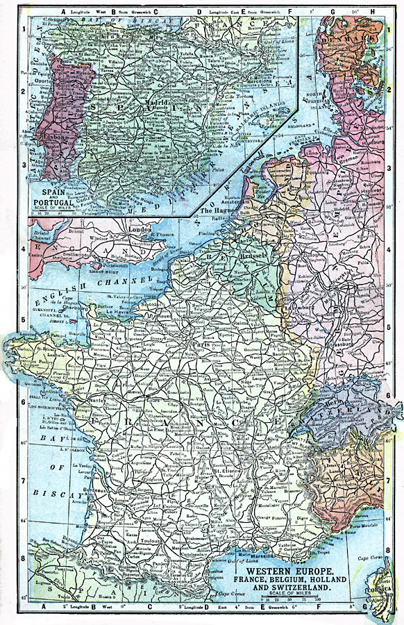
Description: A map from 1903 of Western Europe showing the political boundaries of Denmark, the western portion of the German Empire, Holland, Belgium, Luxemburg, France (including Corsica), and Switzerland, with an inset map of Spain and Portugal. The map shows major cities and towns, railroads, rivers, and mountain systems of the region.
Place Names: Western and Central Europe, France, �Germany, �Holland, �Denmark, �German Empire, �Switzerland, �Italy, �Spain, �Portugal, �United Kingdom, �England, �Belgiu
ISO Topic Categories: transportation,
oceans,
location,
inlandWaters,
boundaries
Keywords: Western Europe, physical, �political, �transportation, physical features, country borders, roads, transportation,
oceans,
location,
inlandWaters,
boundaries, Unknown, 1903
Source: W. R. Hearst, The American Almanac, Yearbook Cycopedia and Atlas 2nd ed (Chicago, IL: Hearst's Chicago American, 1903) 313
Map Credit: Courtesy the private collection of Roy Winkelman |
|