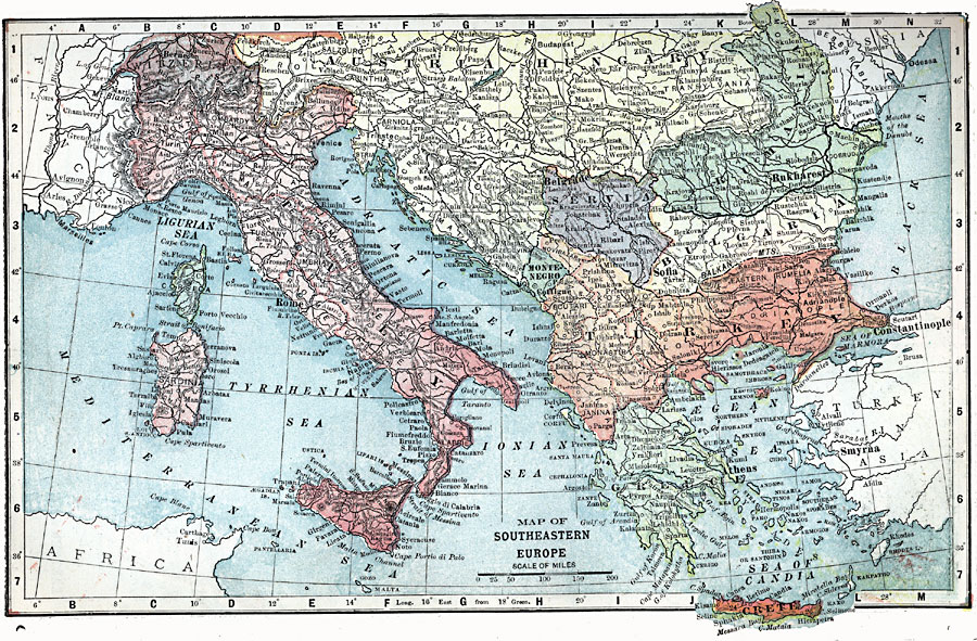
Description: A map from 1903 of Southeastern Europe showing Switzerland, Italy, Corsica, Sardinia, Rumania, Servia, Montenegro, Bulgaria, Greece, the European extent of Turkey, and the Austria–Hungary provinces of Tyrol, Carinthia, Slavonia, Carniola, Croatia, Transylvania, Dalmatia, and Bosnia. Major cities and capitals, railways, rivers, mountain systems, and coastal features are also shown.
Place Names: Western and Central Europe, Austria-Hungary, �Italy, �Bulgaria, �Turkey, �Greece, �Serbia, �Romani
ISO Topic Categories: boundaries,
transportation,
inlandWaters,
location,
oceans
Keywords: Southeast Europe, physical, �political, �transportation, kEuropeanOttomanEmpire, physical features, country borders, roads, boundaries,
transportation,
inlandWaters,
location,
oceans, Unknown, 1903
Source: W. R. Hearst, The American Almanac, Yearbook Cycopedia and Atlas 2nd ed (Chicago, IL: Hearst's Chicago American, 1903) 336
Map Credit: Courtesy the private collection of Roy Winkelman |
|