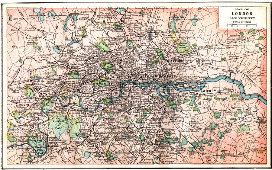
Description: A map of London and vicinity from 1903, showing first class and secondary roads, railways and rail stations, canals, the River Thames, urban areas and suburbs, parks, landmarks, and neighboring cities, towns, and villages.
Place Names: United Kingdom, Londo
ISO Topic Categories: boundaries,
inlandWaters,
location,
transportation,
structure
Keywords: London and Vicinity, physical, �political, �transportation, physical features, local jurisdictions, roads,
railroads, boundaries,
inlandWaters,
location,
transportation,
structure, Unknown, 1903
Source: W. R. Hearst, The American Almanac, Yearbook Cycopedia and Atlas 2nd ed (Chicago, IL: Hearst's Chicago American, 1903) 433
Map Credit: Courtesy the private collection of Roy Winkelman |
|