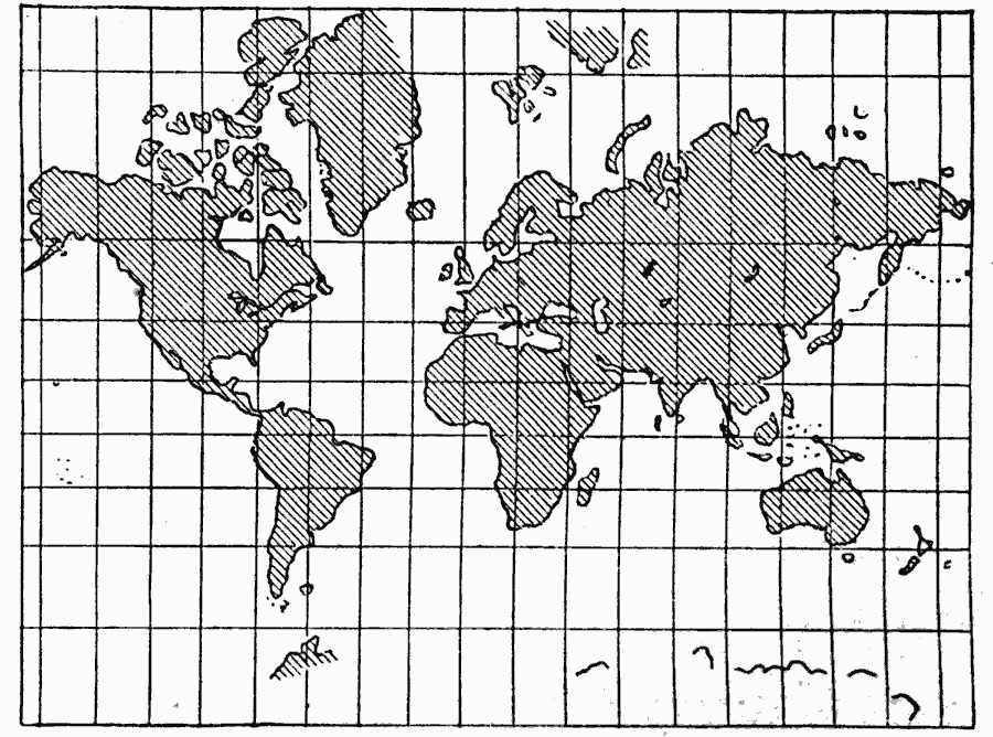
Description: A map from 1909 showing the world on a Mercator's Projection. "In Mercator's Projection, the meridians and parallels are straight lines crossing at right angles, and the spaces between them are so proportioned that any continuous direction on the earth's surface may be represented by a straight line on the map. Hence, every change in direction of any line on the map represents a corresponding change in the direction of the line it represents on the earth's surface. Therefore, this projection is useful when relative directions in different parts of the earth are to be compared, as the directions of different ocean currents, etc. The scale of the map, however, is not uniform, but increases rapidly and irregularly from the equator toward the polar regions. Thus, Greenland is represented as larger than South America; whereas, it is really less than one eighth as large." — Hinman, 1909, p. 53.
Place Names: A Complete Map of Globes and Multi-continent, Africa, �Asia, �Australia, �Europe, �North America, �South Americ
ISO Topic Categories: location,
inlandWaters,
oceans
Keywords: Mercator's Projection of the World, physical, kMapProjection, physical features, location,
inlandWaters,
oceans, Unknown, 1909
Source: Russell Hinman, Eclectic Physical Geography (Cincinnati, Ohio: Houghton Mifflin Company, 1888) 53
Map Credit: Courtesy the private collection of Roy Winkelman |
|